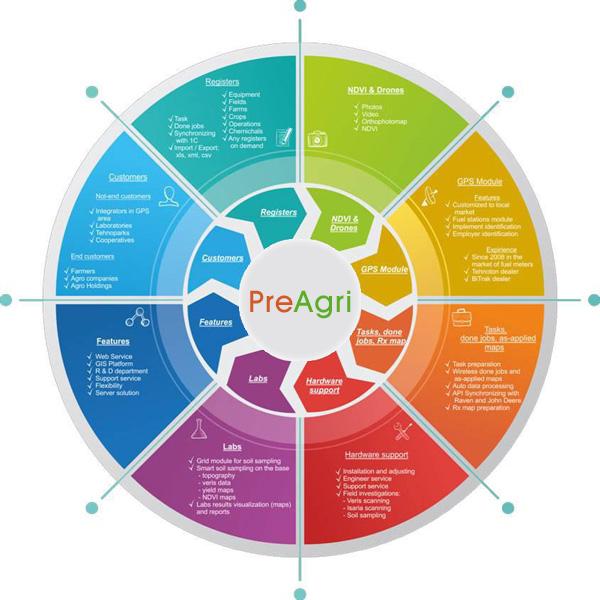
Crop management system

The digital system for agriculture that helps grow your business

  • Connect equipment and services

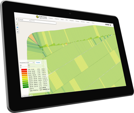
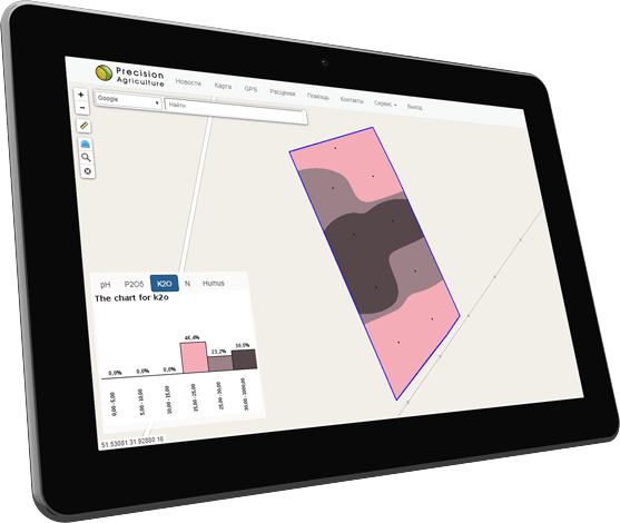
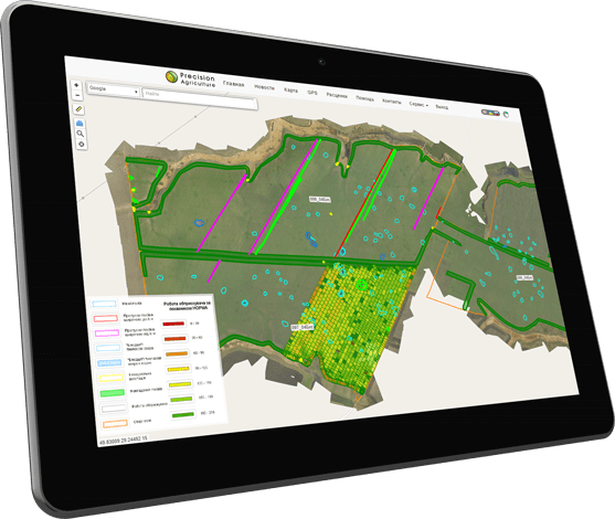
  • Upload and store data about your fields

  • Control field operations in real time

  • Rate the quality of the work performed and resources expended

  • Note the heterogeneity of fields for the rational use of resources

  • Get the maximum profit per hectare without extra costs

Agrochemical analysis and prescription maps

for soil testing companies

Planning of sampling places and processing of results of agrochemical analysis, density, electrical conductivity and other indicators.

Make of prescription maps for field equipment based on recommendations.

More »

Calculation of hectares and agricultural reports

for dispatch GPS centers

Automated field processing calculation for the department of satellite monitoring for transport.

Creation of agricultural reports on all equipment and land fund of the company.

More »

Crop condition monitoring

for farmers and agronomists

Field works planning, integration with weather forecasting systems and weather stations.

Inspection of fields using photos and videos. Monitoring of the condition and development of crops based on satellite images.

More »

Downloaded
field
boundaries

Connected
field
equipment

Processed
field
works

SAVINGS FROM THE INTRODUCTION

Precision farming systems allow you to control introduction of seeds, fertilizers, herbicides and monitoring of fuel consumption and labor

You can make fertilizer and other materials in the required amount and where it is needed with help of the precision farming system

This helps to save on the amount of materials, execution time and resources involved

    Automated hectare calculation 10% - 20%
    Prescription maps 5% - 10%
    Total savings 15% - 30%

Online exchange data with field equipment Raven, Trimble and John Deere

All spatial data of the company
in one solution

Fields history
Agrochemical analysis
Orthophoto plans
Weather stations
Calculation of hectares
Field works
Satellite images
Photo and video

Import and export data for the field equipment Raven, Trimble, John Deere, Topcon, Veris, Leica

The exact introduction and control over the performance of work
Displaying yield data on the map allowed to visually assess the benefits of the introduction of precision farming systems, calculate the savings, identify problems with the introduction of the products immediately after work and take the necessary measures without waiting for the first shoots

Irina Shmygol
Agri 2.0

Irina Shmygol - Agri 2.0
Agrochemical soil survey, recommendations on the application of fertilizers
The service allowed to provide our clients with convenient Access to agrochemical survey data and the ability to collect and analyze other spatial data. Complex approach to information processing allows to study in detail the features of each field, provide reasoned recommendations, follow the implementation of the compiled nutrition and protection program, and evaluate the benefits

Lyudmila Vasilenko
Prime Lab Tech

Lyudmila Vasilenko - Prime Lab Tech
Interactive maps of fields
Service allows you to display data of quality planting with help of UAV, which in combination with other data, allows create detailed interactive maps that reflect the real state of fields

Aleksey Gusak
Mapgeosystem

Aleksey Gusak - Mapgeosystem

Order service demonstration