Telematics module

Allows you to combine telematics and precision farming in one solution

Auto creation of agricultural reports - performed works volumes, types and areas, considering different processing times at field, variable machines, trailed and operators all over the land bank of the company.

Real-time automatic calculation of the performed works area

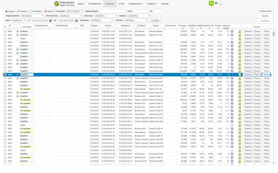
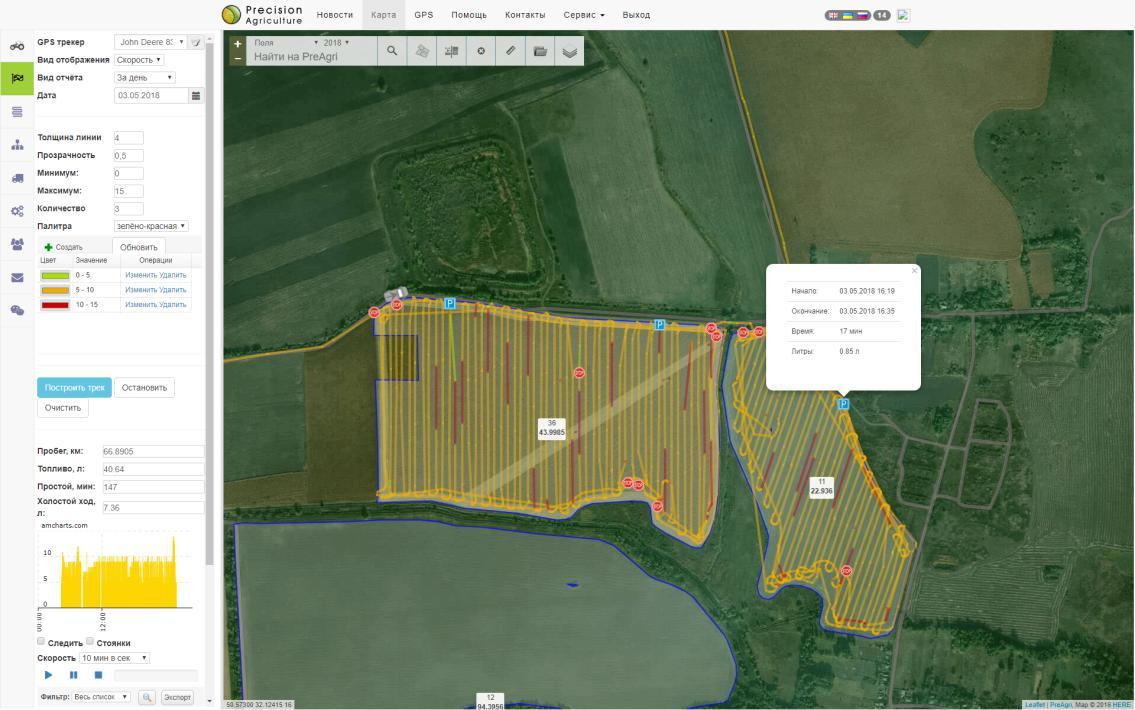
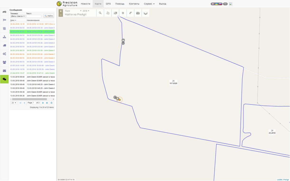
A smart algorithm has been developed that allows you to keep a log of fieldwork based on data obtained from telematics equipment as well as through an API (Wialon for ex.). The operation log contains real-time updated information about performed works volume.
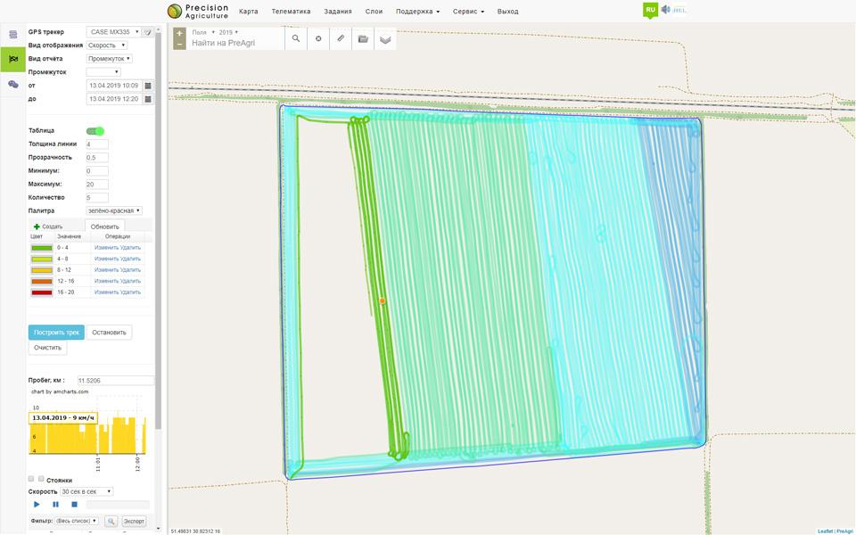
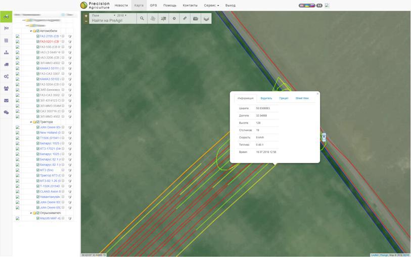
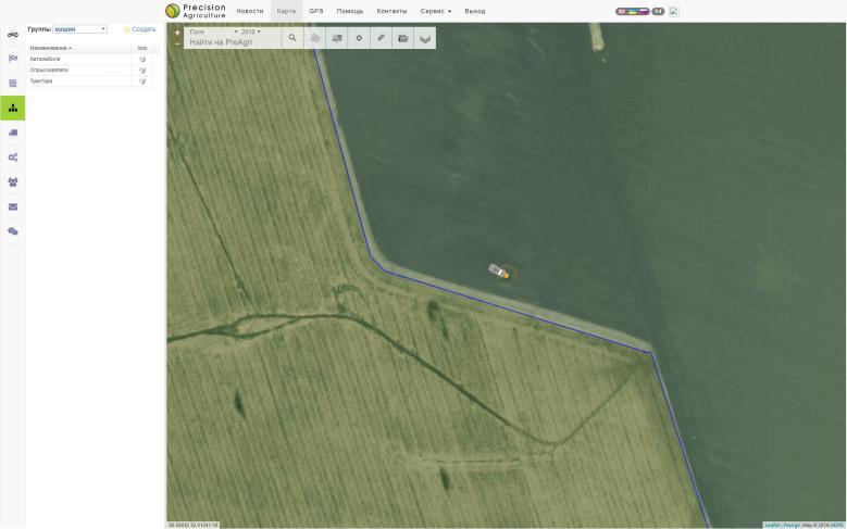
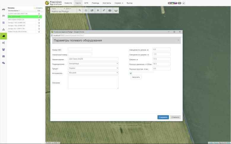
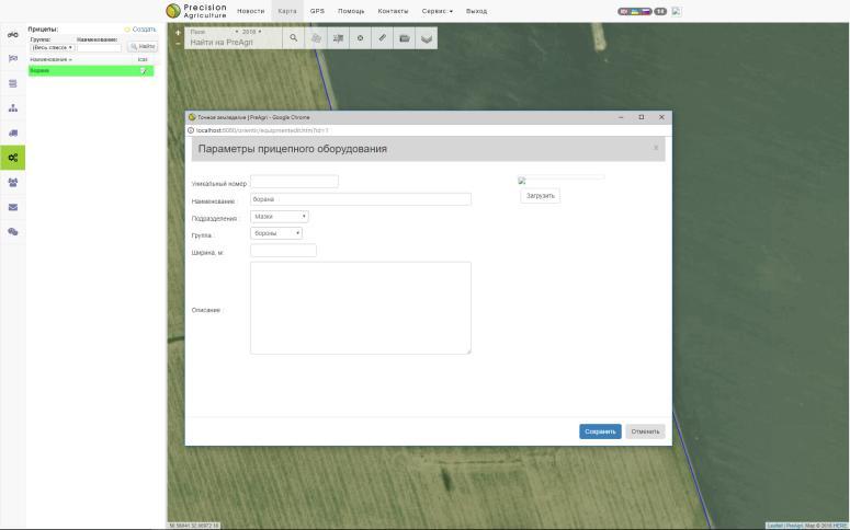
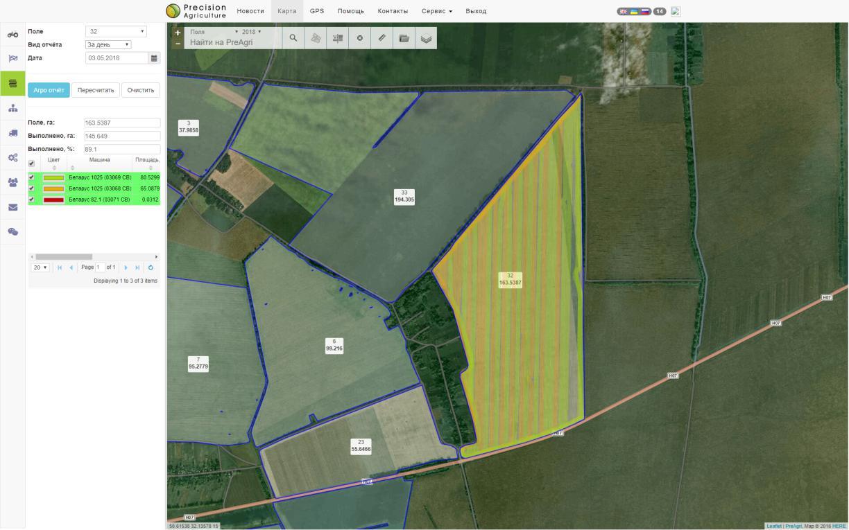
The server collects and synchronizes information about all equipment, automatically determines the work inside the company’s field, the unit and the operator. It fixes the area of work taking into account the width of the trailed equipment, displacement of the receiver, driver and shift. The system automatically generates a register of field works with a display of the total volume of works by fields and different technological operations.
The list of operations is available to the dispatch service for checking and closing the works. There is the possibility of adjusting the parameters of fieldwork, recounting and obtaining an agricultural report. REST API allows you to get a dynamic list of field works with filter support from external systems (1C for ex.).

Access to monitoring system

Buy

Agricultural reports

Field works list
Processing route report

Data collection

TCP and HTTP protocols

REST API Support

Import from WLN, CSV, GPX files

Compatibility

Integration

REST API integration Directly from the database or REST API development REST API integration

Monitoring

Map movements

Equipment structure by division and category

Track visualization

Tracker options

Main settings

Equipment photo

Additional Information

Sensors settings

Directories

Groups Equipment

Trailers Drivers

PreAgri demonstration

Visualization

Track display

Display settings

Chart and table

Map markers

Tracks playing

Data export

Agricultural reports

Field work performed report

Time span selection

Equipment selection

Overlap report

Geofences and points of interest

Geofences

POI - points of interest

Online editor

Color, transparency and radius adjustments

Notifications

Setup notifications

Informing

Text with variables

Messages

Message list display

Filter and highlight messages

Map positioning

Feel free to contact us Our contacts