Planning and processing soil analysis indicators

PreAgri allows you to plan soil tests and process the results of agrochemical analysis, density, electrical conductivity and other indicators

Formation of a SHP task map for field equipment based on recommendations

Planning and import

Cartograms and reports
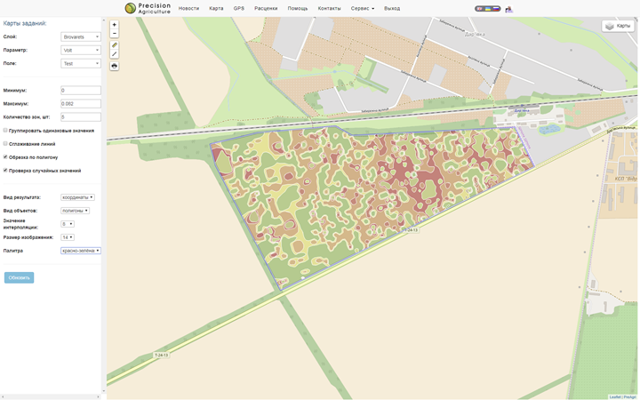
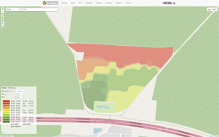
Prescription maps

Making boundaries

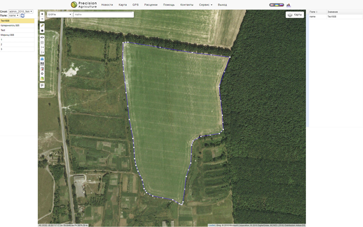
Creating a field contour

orthophotoplan vectorization

auto-formation for field work

import from files SHP, KML, KMZ, GeoJson


Planing soil tests

Classic method

field contour selection

determination of the samples number

rotation editing and grid offset


Saving results

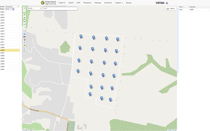
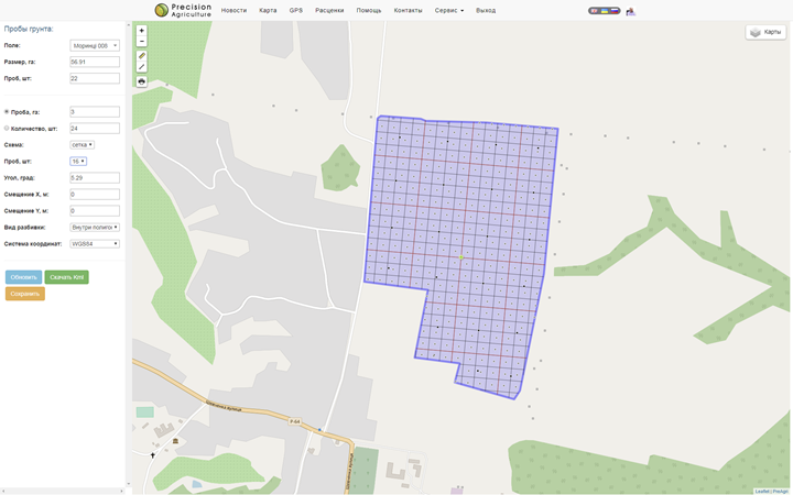
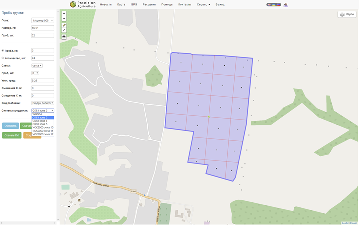
Create a layer with dots and a grid

layer name

point number mask

number format and save type

export in format kml, kmz, shp, dxf, xls, csv

Isolation of inhomogeneities

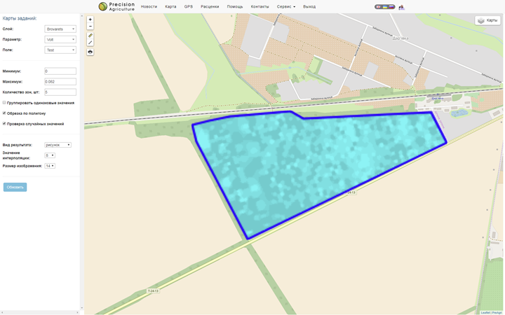
Zone selection according to data

electrical conductivity

soil density

soil scanning

relief

NDVI maps

Importing and editing indicators

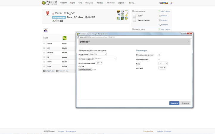
Entering soil analysis results by elements:

filling in the layer editor

appending data from files in the format xls, csv

import from files shp, kml, kmz, csv, gdb, dxf


Cartogram settings

Elements list:

arbitrary creation

editing display options

automatic construction of cartograms for all fields

Request a system demo

Building cartograms

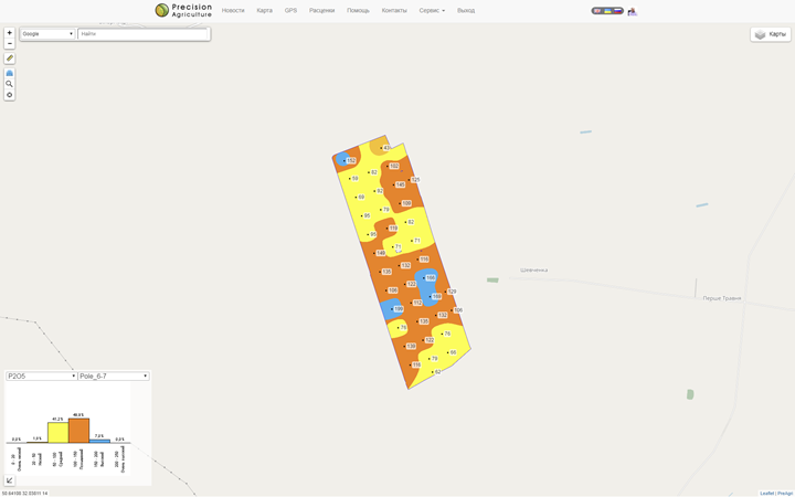
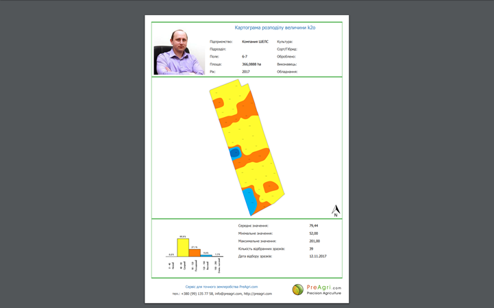
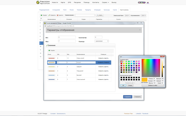
Building cartograms:
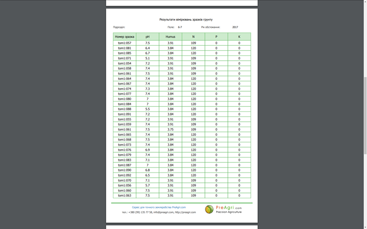
field and indicator selection

cartogram display

legend and meanings


Printing reports

Reporting forms:

ability to customize reports

preview

saving in PDF format


Creating prescription maps

Formation and saving of maps:

building a map according to recommendations

creating a layer with results

editing norms

export to SHP file

sending the map to the field equipment

Contact us if you have additional questions Contacts